The Estrada Real (English: Royal Road) has more than 1,600km of extension, it is currently the largest tourist route in Brazil. There are four distinct paths that cover at least 160 municipalities through the Brazilian states of Minas Gerais, Rio de Janeiro and São Paulo.
Driving along the Estrada Real was one of the most complete travel experiences I’ve ever had in Brazil. A journey that is full of history and local tales, natural beauty, good food, prehistoric paintings, incredible hospitality, and even a special passport for travelers exploring the region.
In this article, I share all the tips for you to start planning your trip through the memories of a period that was marked in Brazilian history.
How it all began…
At the time of Colonial Brazil, with the discovery of gold in the 17th century, the Portuguese crown ordered the construction of a mandatory road for the transport of goods between Minas Gerais and the port of Paraty. From Paraty, the goods, mainly gold, were sent by sea to the port of Rio de Janeiro, before being shipped to Europe.
The Brazilian territory already had several trails used by indigenous peoples long before Portuguese colonization. With the construction of the royal road, more paths were opened and started to be used also by the tropeiros, who were traders that integrated the south and southeast regions of Brazil.
Read also: The story of Feijão Tropeiro (Tropeiro Beans), the Brazilian nomadic dish
The Brazilian Royal Road as a Tourist Route
The revitalization of these paths as a tourist route began approximately 20 years ago. According to the Estrada Real Institute, the project is a way to preserve the intangible cultural heritage and promote the development of the region. Today, the Estrada Real incorporates different types of tourism such as cultural, religious, agritourism, ecotourism, adventure, and food tourism.
The paths of Estrada Real
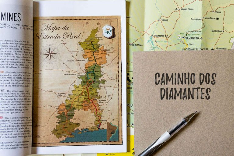
The main paths of Estrada Real are called: Caminho Velho (Old Path), Caminho Novo (New Path), Caminho dos Diamantes (Diamond Path) and Caminho do Sabarabuçu (Sabarabuçu Path). There are also other thematic routes, such as the Religious Path.
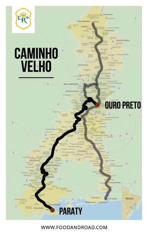
Caminho Velho / Old Path
It was the first official path built to connect the city of Ouro Preto to the port of Paraty. The Caminho Velho is approximately 700 km long with dirt roads for the most part.
In addition to Ouro Preto, the route along the Old Path includes cities and towns like Tiradentes, Congonhas, São João del-Rei, São Tomé das Letras, Aiuruoca, São Lourenço, Caxambu, Aparecida and Paraty.
Caminho Novo / New Path
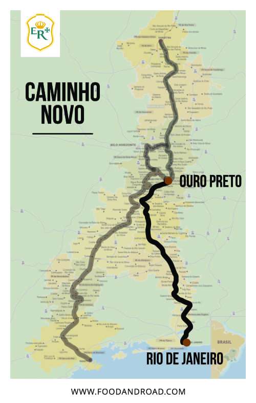
The Caminho Novo (New Path) was created as a solution to the insecurity that threatened the sea route from Paraty to the port of Rio de Janeiro and to avoid the difficult routes imposed by Mantiqueira Range. With this new path, the goods travelled by land from Ouro Preto to Rio de Janeiro on a route of approximately 500 km, shorter and currently more paved than Caminho Velho.
Along the Caminho Novo, you will pass through cities like Ouro Preto, Itatiaia, Juiz de Fora, Petrópolis and Rio de Janeiro.
Caminho dos Diamantes / Diamond Path
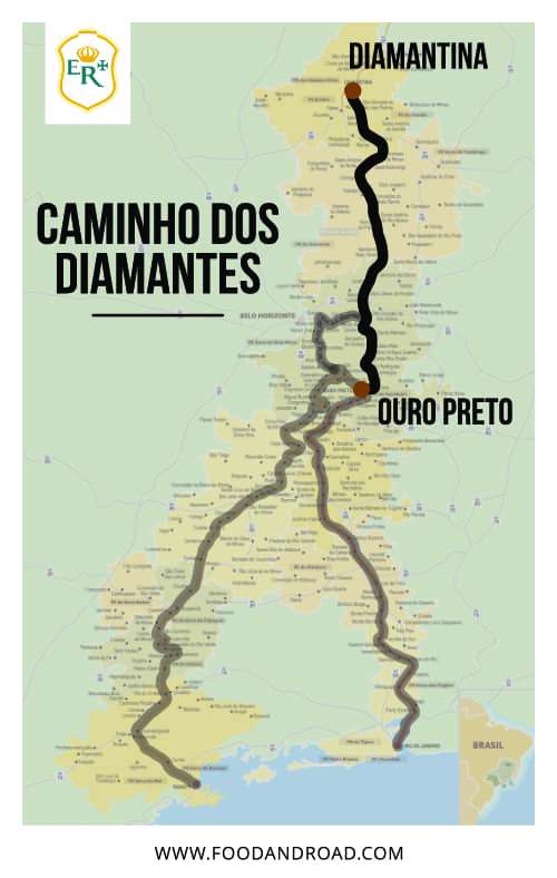
The discovery of diamonds in the Serro region, located north of Ouro Preto, resulted in the extension of Caminho Velho to connect the city of Ouro Preto with the current city of Diamantina. The Caminho dos Diamantes (Diamond Path) is 395 km long and stands out for its exuberant nature, historic cities and excellent cuisine.
The main cities and towns include Diamantina, São Gonçalo do Rio das Pedras, Milho Verde, Serro, Conceição do Mato Dentro, Ipoema, Cocais, Catas Altas, Mariana and Ouro Preto.

Caminho do Sabarabuçu / Sabarabuçu Path
The continuous search for gold led to the creation of the last path on our list, the Sabarabuçu Path. Towards Piedade Range, which instead of gold had iron ore, the Sabarabuçu Path starts in the city of Cocais and ends in Glaura, covering 160 km.
This is the shortest path and closest to Belo Horizonte, the capital of Minas Gerais. It passes through Caeté, Sabará, and the iconic city of Itabirito, a mandatory gastronomic stop to taste the famous Pastel de Angu de Itabirito.
How to travel through the Estrada Real – Planning Tips
Best of all, you can venture down the paths in different ways. The flexibility is one of the most fascinating features of this tourist route. After all, you can plan everything according to your preference and available time.
Transport
To choose the mode of transport, it depends a lot on the style of the traveller. All means of transportation are possible, by car, motorcycle, horse, bicycle and even on foot.
The main thing is to be prepared for dirt roads. We drove the Diamond Path with an SUV car (rented here), it wasn’t 4×4, and in general, we did well. But, in rainy situations, some parts could have been more challenging.
If your plan is to go biking or walking. Pay attention to the number of ascents and descents in each direction of the route. For example, the Diamond Path requires less physical effort from Diamantina to Ouro Preto than the other way around.
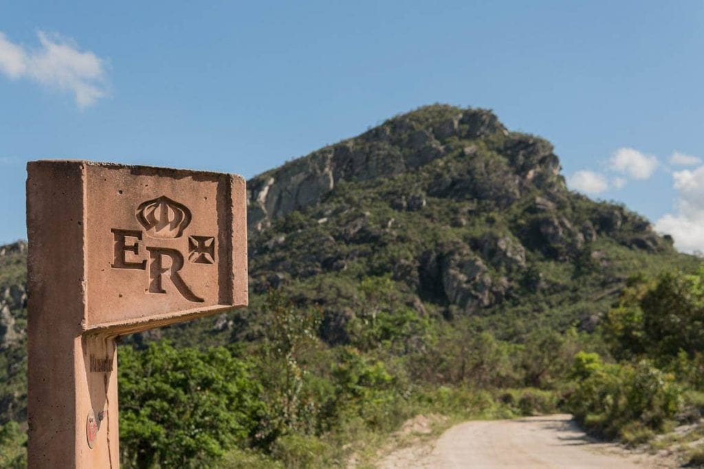
Totems
Travelling along the Estrada Real is not the same as driving on highways and paved roads from one city to another, but travelling through historic paths, of dirt, stone, which often seem to make no sense, at the same time that you are surrounded by nature and wonderful views. To help you get into this adventure, there are Totems of Estrada Real, which are the best indicators to show you’re on the right path.
In the itinerary section of the Instituto Estrada Real website, you can download several maps and spreadsheets containing useful information about roads, totems, checkpoints, sights and more.
Coordinates
It is important to always have a map of Estrada Real with you and preferably an offline map on your cell phone. We used the trail app wikiloc and maps.me which worked very well, even to find waterfalls in the region. In maps.me, choose the bike route, even if you are riding a car, it is more guaranteed that you will follow the correct path instead of ending in large paved roads.
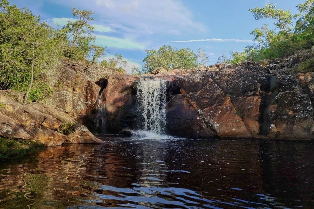
Tip: If your goal is to explore all the waterfalls along the way, it’s worth checking out the Cachoeiras da Estrada Real app.
Where to stay
All roads are full of cosy inns, urban and rural, it is also possible to camp or stay in the homes of local residents.
You can book your accommodation in advance online, but if you want a more flexible travel plan, especially in smaller cities, you can search directly at the destination.
Options of Hotels
Click on the city to see available options and daily rates.
- Diamantina
- Tiradentes
- Serro
- Milho Verde
- Catas Altas
- Ipoema
- São João del-Rei
- Ouro Preto
- Itabirito
- Aparecida
- Paraty
Best time to go
In theory, it is possible to go at any time of the year, but it’s better to avoid the rainy season – December to March. This way you’ll be able to enjoy the surrounding nature and not worry about muddy roads and potential risks at the top of the waterfalls caused by rains.
Another tip for planning when to go is to search the calendar of local festivals. There are religious, gastronomy, music, art festivals, etc. In this way, no matter how much you know about Brazil, you will always learn something new from the local culture.
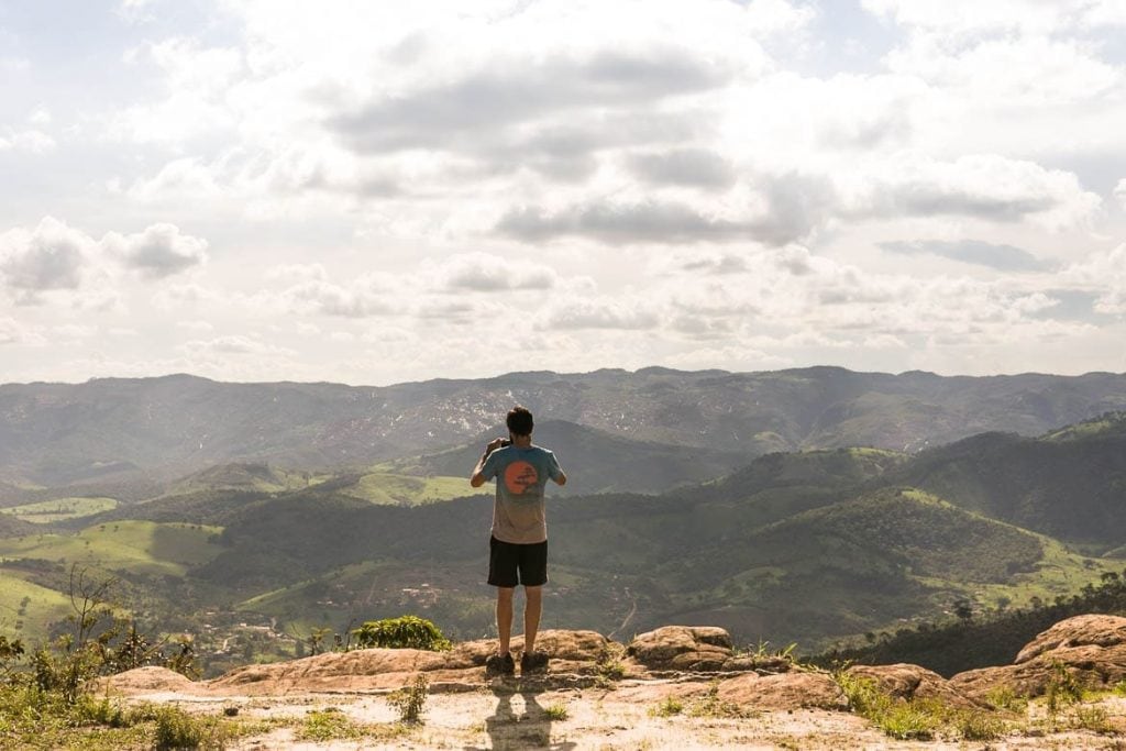
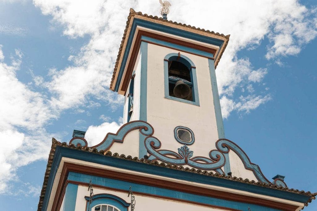
What awaits you on the paths
Estrada Real is the largest tourist route in Brazil and the variety of attractions along its paths is immense.
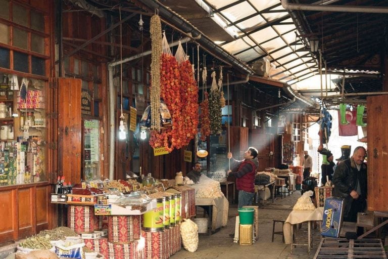
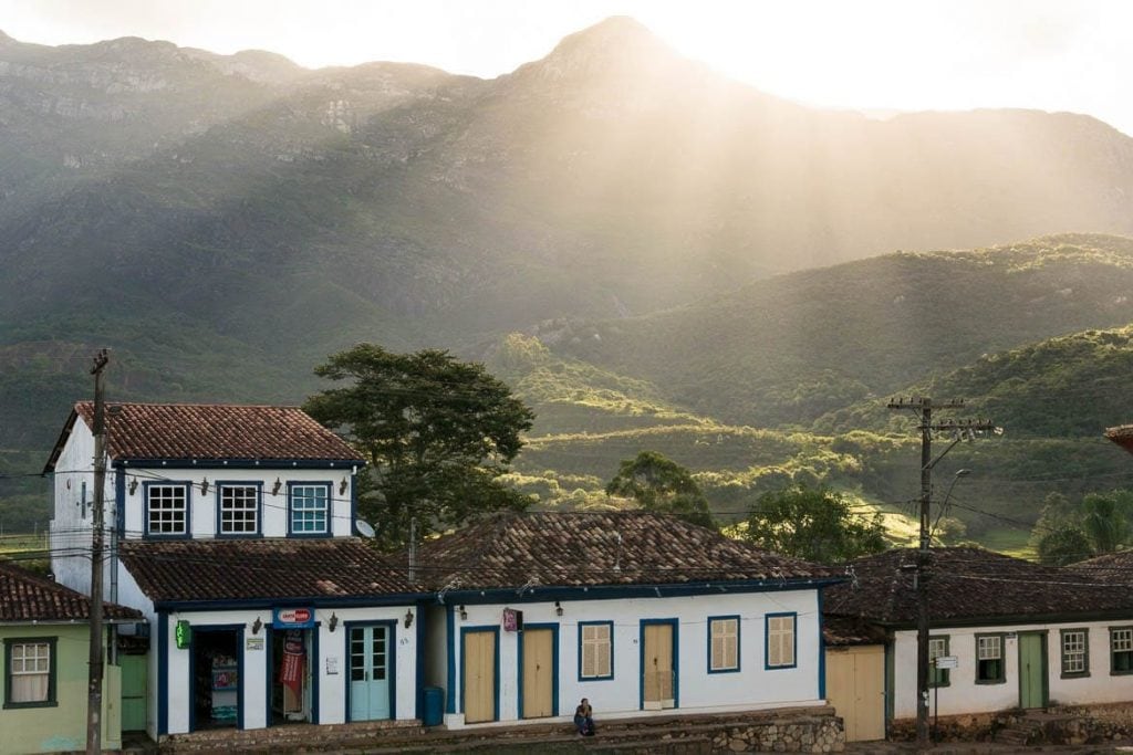
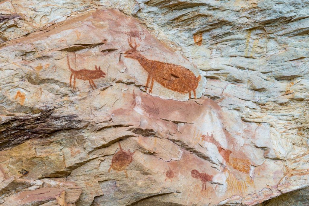
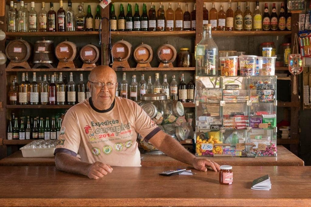
It has something for everyone, bucolic landscapes, typical cuisine in traditional restaurants and local markets, museums, churches, beautiful waterfalls – large and small, trails, national and state parks, caves, prehistoric paintings, baroque architecture with its sculptures, cachaça distilleries (Brazilian National Spirit), coffee plantations and the best, the local hospitality.
Our experience with Estrada Real was incredible and in the gallery below you can see a little of what awaits you there!

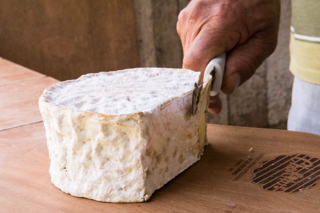
Viewpoint Waterfall in Milho Verde Historic Church in Diamantina Cheese in Serro Prehistoric Paintings in Cocais Checkpoint in São Gonçalo do Rio das Pedras
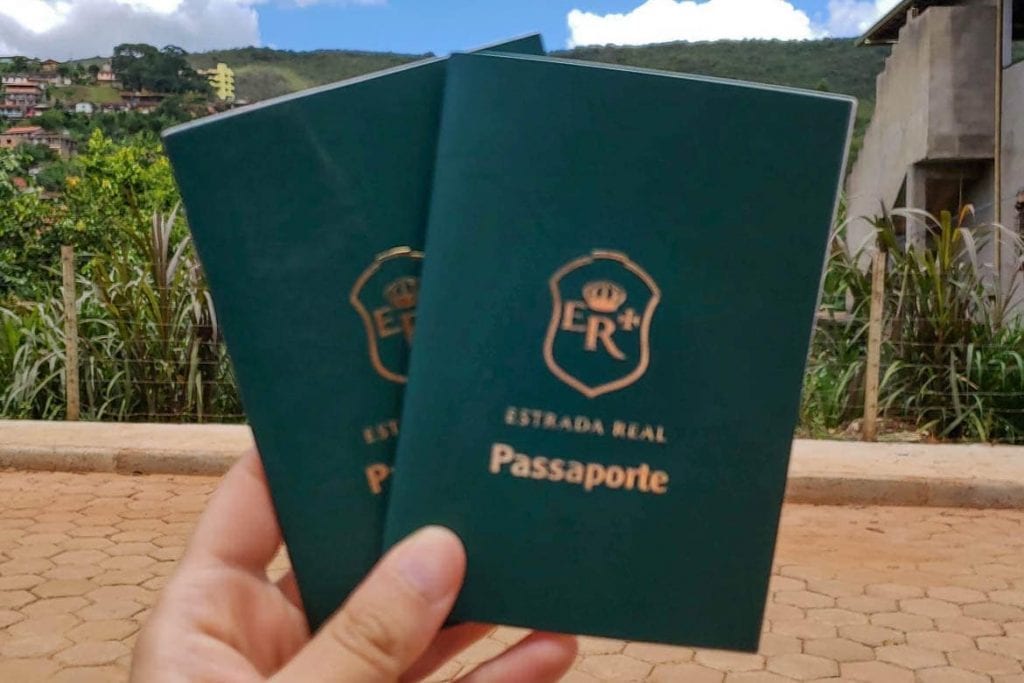
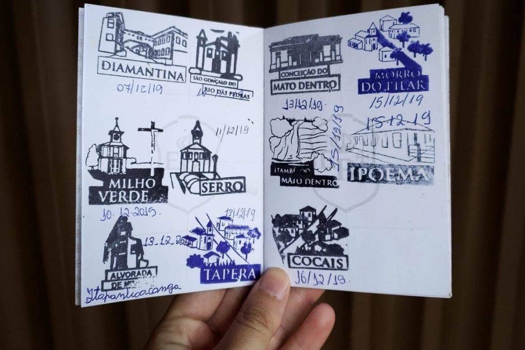
Get your passport from Estrada Real
Here is a really cool tip for those who want to travel on the Estrada Real or just visit some cities that are part of the official route. You can get an exclusive passport from the Institute that manages the route and use it to stamp your passage through the main cities along the paths.
From our experience, the trip gets much more interesting with the passport. The quest of getting the stamp becomes part of the adventure, the search for checkpoints generates interaction with local people, in addition to being a great souvenir.
To collect your passport, you must first complete an online form on the Institute’s official website and when you go get it, take 1 kg of non-perishable food or 1 piece of clothing for donation along with the confirmation email you will receive after completing the form. The cities that issue the passport are Diamantina, Tiradentes, Ouro Preto, Cocais, Glaura, Petrópolis and Paraty.
Each stamp is represented by a tourist spot of the city and also counts as a checkpoint to collect your traveller’s certificate, that we talk about it next.
Be sure to get the traveller’s certificate
The stamps in the passport are entitled to a Certificate of Completion of the Path. To obtain the certificate, a minimum number of stamps is required, which varies according to the path taken.
- Caminho Velho (Old Path) – 14 stamps
- Caminho Novo (New Path) – 8 stamps
- Caminho dos Diamantes (Diamond Path) – 10 stamps
- Caminho do Sabarabuçu (Sabarabuçu Path) – 4 stamps
We already got the Diamond Path certificate, what are you waiting for?